This is an alternative trek in the Everest region that not only avoids the crowded “Everest Highway” but also offers much more of this spectacular region. A scenic flight to Lukla begins your adventure in the Everest region. Trekking through high alpine valleys following the milky white rivers, we reach the “Sherpa Capital”, Namche Bazaar. After a couple of days spent here for acclimatization, we leave the “Everest Highway” and head west towards Thame Valley. This particular valley is amazingly picturesque, not only because of the breathtaking views of the mountains, but also you can see much more of the traditional Sherpa villages and their lifestyle in a relaxed atmosphere due to much fewer tourists. Thame is a picture perfect village with traditional houses, local lifestyle and their culture, terraced mountain farming and crowned by a beautiful monastery. After Thame, we head north in the direction of the Tibetan border of Nangpa La to Lungden. Here we spend a couple of days for acclimatization before we proceed to cross to the Renjo La. Renjo La pass is famous for being one of the best vantage point in the region with breathtaking views of Mt. Everest, Mt. Lhotse, Mt Makalu, along with dozens of high peaks and a bird’s eye view of the turquoise lake of Gokyo. After the pass we continue to Gokyo, where you can see high alpine lakes and glaciers headed by Mt. Cho Oyu to the North. Walking down the Gokyo valley we will come to the beautiful traditional villages of Phortse and Upper Pangboche.
Overview
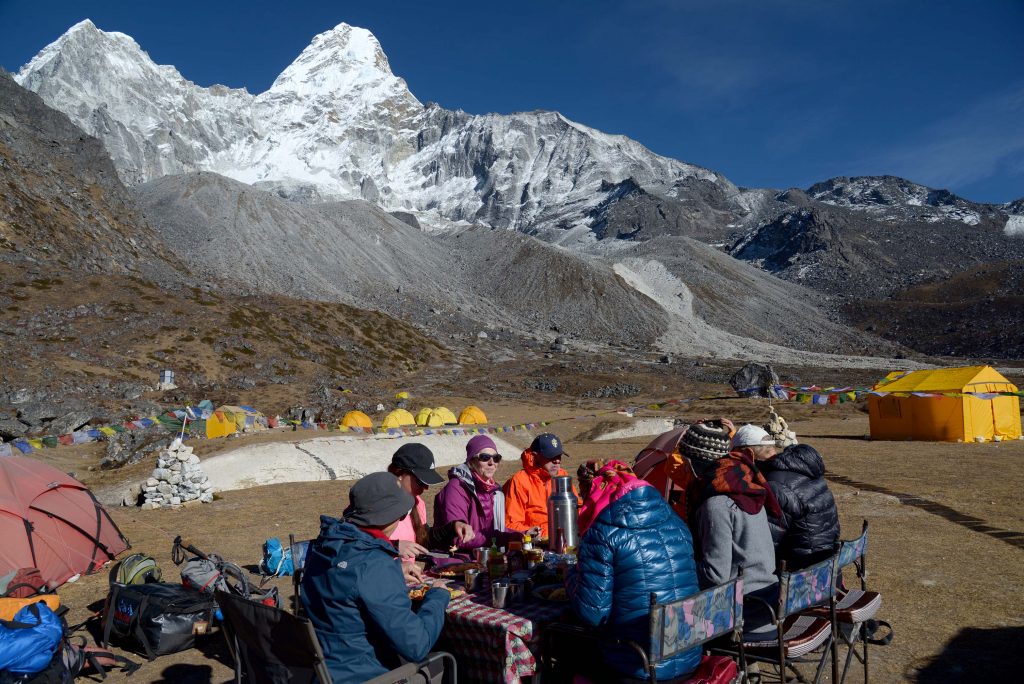
The crowning of this trip will be the overnight stay at the Base Camp of Mt. Amadablam, which is considered to be the most beautiful mountain in the Himalaya! On our return journey we will pass by Tyangboche Monastery, considered as a photographer’s favorite place due to its striking location with Everest and Amadablam as a backdrop.
Highlights:
- Mountain flight to Lukla
- Namche Bazaar- the Sherpa capital of the Khumbu
- Tyangboche monastery- a 200 year old monastery situated on a ridge surrounded by massive mountains.
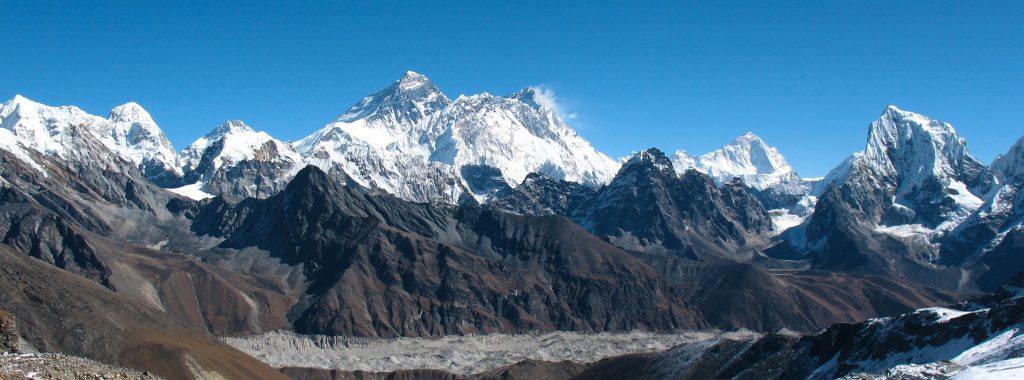
- Renjo la- the best vantage point of the Everest massif and its surrounding peaks
- Gokyo Ri- Views of 4 of the 6 highest mountains- Mt. Everest (8848 m), Mt. Lhotse (8510 m), Mt. Makalu (8467 m) and Mt. Cho Oyu (8201 m)
- Amadablam Base Camp- the most beautiful Base Camp in the Himalaya
- Sagarmatha National Park, listed as a World Heritage Site by UNESCO
Itinerary
Once you reach KTM airport and finish with the immigration and custom formalities be prepared to confront the confusion outside the airport which is common in most of the south Asian countries. As you walk out of the Exit door into the passenger pick up area you will see hundreds of people with different sign boards in their hands, taxi drivers looking for fares, hotel touts looking for customers and porters trying to help with the luggage for tips. Please remain calm and do not walk out of the restricted area into the crowd straight away. Remain there and try to find the Hi On Life’s sign board. Once you spot it, walk straight to the signboard and identify yourself. From here we will take care of you.
When you arrive to your hotel you will be briefed about your activities and “do’s and don’ts” while your stay in Kathmandu. We will also collect some documents from you. Please have the following things handy when arriving.
Travel/ Medical Insurance (photo copy)
3 passport size photos
Photocopy of your passport.
In the evening we will go for a traditional Nepali dinner at Kathmandu’s finest Nepali restaurant to end the day.
Drive: 145 km, 5 hours
Elevation of Ramechhap: 475m
The recent decision taken by the Ministry of Civil Aviation of Nepal states that all flights to Lukla will originate from a place called Ramechhap. After breakfast we will drive to Ramechhap. The drive takes us out of Kathmandu valley through Bhaktapur and Dhulikhel along B.P Highway. We will drive along the Sun Koshi river to a place called Khurkot, which is situated at the confluence of the Sun Koshi and Tama Koshi. Here we will cross a bridge and leave the Sun Koshi and then follow the Tama Koshi to Ramechhap.
Overnight tourist lodge at Ramechhap
Flight: 15 mins
Trek distance: 11 kms
Trekking: 4 hours
Elevation of Lukla: 2850m
Elevation of Benkar: 2750m
Usually it will be an early morning flight which is a small 17 seated Twin Otter or Dornier aircraft will take us from Ramechaap to Lukla. The flight times can be flexible because we need clear weather both in Ramechhap and Lukla to be able to fly. So this can sometimes involve waiting for a long time. Once we get the all clear signal we take off to our destination on a 15 min scenic mountain flight to Lukla.
Upon arrival at Lukla, we will take some refreshment at the Paradise Lodge in Lukla. Soon we are treading on the legendary “Everest Highway” which heads downwards through the alpine valley following the “Dudh Kosi” or Milk River (named after its milky color from glacial silt). We reach Benkar after a half a day walk and end our first day here. Benkar is situated at the bank of Dudh Kosi and the lodge that we will stay at, has a beautiful waterfall behind and an amazing view of Mt. Thamserku (6636m) right in front of you.
Distance: 8 kms
Trekking: 6 hours
Elevation Namche Bazaar: 3440m
Today we have an easy walk in the morning following the Dudh Kosi crossing it several times on long suspension bridges. We reach Monjo after 2 hours walk which is the entrance to the Sagarmatha National Park. Here we get your National Park Permits. 30 mins from here, we reach Jorsale where we stop for lunch.
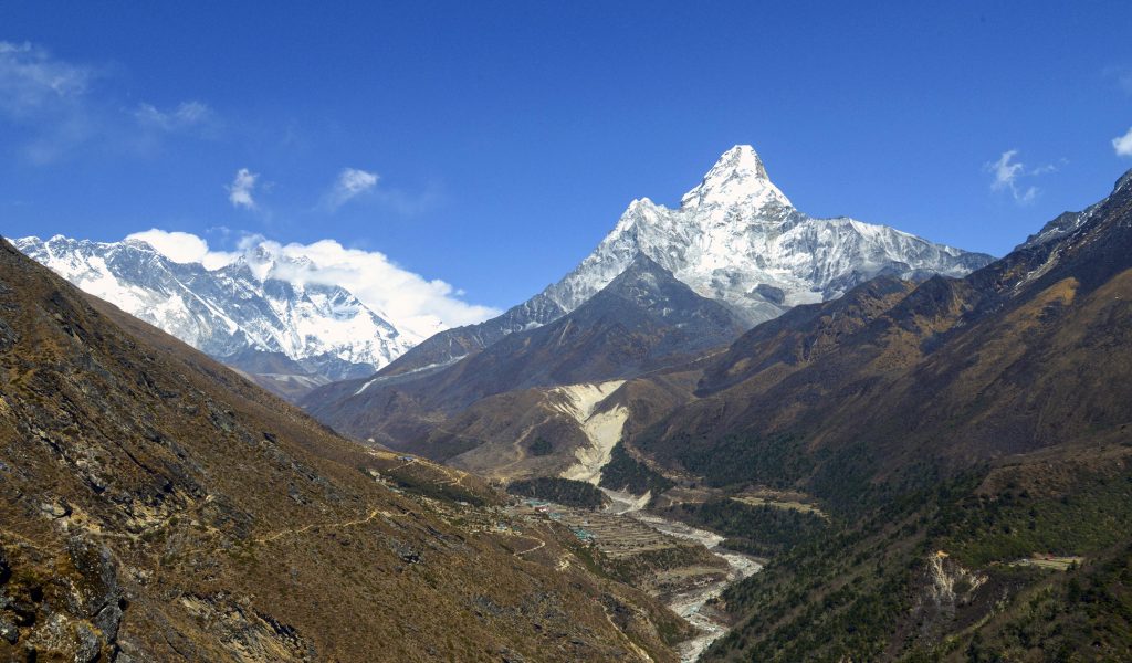
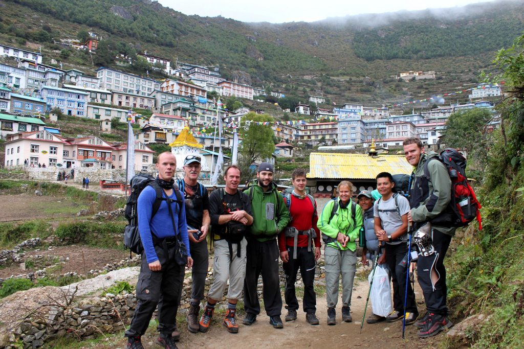
After lunch we continue to trek along the Dudh Kosi for 45 mins to reach Larche Doban, which is the confluence of the Dudh Kosi and Bhote Kosi. Here we cross the famous suspension bridge which is about a hundred meters above the river and 113m long. After crossing this bridge, it is a steady climb for 1 ½ hours to reach Namche Bazaar, which is the Sherpa capital of the Khumbu region. On a clear day you get views of Everest, Lhotse, Thamserku, Kusum Kangru, Kwangde and Taweche on the way to Namche.
Distance- Hike to Everest view hotel and back: 6 kms
Trekking : 3 hours
Elevation gain and loss on the hike: +/- 400m
As we will have gained about 700m that day, it demands a rest and acclimatization day for the following day. In the morning we will hike to Everest View Hotel where you will have breathtaking views over Mount Everest, Nuptse, Lhotse, Peak 38, Taweche and Cholatse towards the North, and Ama Dablam, Thamserku, Kangtega and Kusum Kanguru to the East. Towards your west the 5 km ridge called the Skyline ridge which is the summit ridge of Mt Kwangde rises majestically along with Teng Kang Poche, Pachermo and Tengi Regi Taw. We will enjoy this fascinating view with warm drinks and biscuits.
You will be back at lunchtime and will have plenty of time to rest or look around the market and shop.
Distance: 10 kms
Trekking: 6 hours
Elevation Thame: 3820m
The trail starts from the Namche Gompa and leads west past a large array of prayer flags, Mani stones and Chortens. The trail is quite easy and it takes about 3 hours to reach Thamo, where we will have lunch. From Thamo we will start to climb towards Thame. The carved Mani stones on the way are some of the most complex and picturesque in Khumbu. Thame is situated in a magnificent kettle surrounded with beautiful and dramatic mountains. Be prepared on awesome sunsets at clear weather!
Distance: 9 kms
Trekking: 5 hours
Elevation Lungden: 4380m
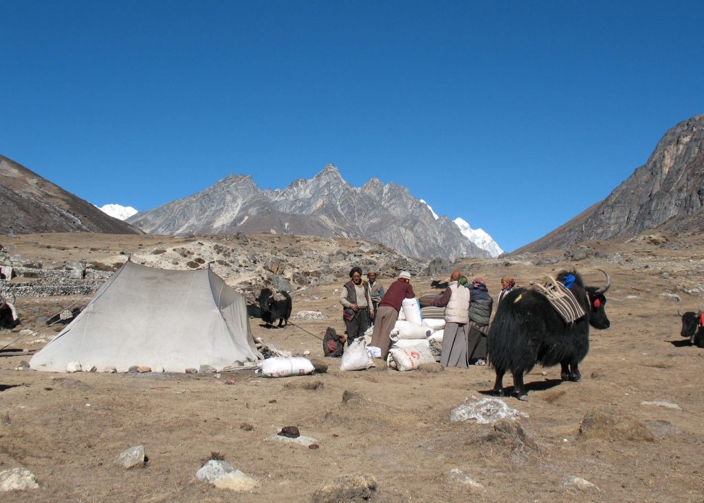
After climbing the ridge above Thame we enter the Bhote Koshi Valley where the river Bhote Koshi runs in the middle. Just as the name reveals (Bothe = Tibetian, Koshi = River) this valley leads to Tibet and the famous pass Nangpa La . It takes about 4 hours to reach a village called Marlung, we stop here for lunch. After lunch, it is another one hour to Lungden. There are just four lodges and they are very basic with only 3 to 4 rooms in each of the lodge.
Distance- Hike to view point and back: 7 kms
Trekking : 3 hours
Elevation gain and loss on the hike: +/- 300m
We utilize this day for rest and acclimatization. We will do a short hike towards Nangpa La, to a small “village” called Ariya. Usually we meet a lot of Tibetan traders here. They are coming with their fully loaded yak caravans from Tibet to sell their gods in Namche. Before we head back to our lodge we get views of the worlds 6th highest mountain, Cho Oyu and many other beautiful peaks both in Nepal and Tibet. In the afternoon we relax and prepare for the next day.
Trek distance: 12 kms
Trekking: 9 hours
Elevation of Renjo La: 5347m
Elevation of Gokyo: 4790m
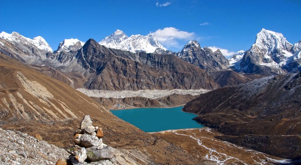
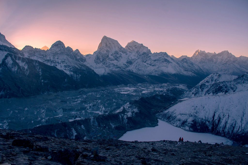
We start early in the morning, generally at 4 to 5 AM. The first one hour of the trek is quite steep. We reach a small dried out lake, from here the trail is a gentle climb for another 2 hrs and finally we reach a big turquoise green lake. From here, the trail is well trodden stony steps all the way to the top of the pass Renjo La which takes about 3-4 more hours. The view from the Pass is extremely beautiful. We get to see a panorama of Everest, Lhotse, Makalu and dozens of other mountains. The view of Everest is one of the best you can get, as you get to see more of Everest from here than from anywhere else in Nepal. After taking pictures, enjoying the stunning view and have a snack to eat we continue down to Gokyo. It takes about 3 hours.
Distance: 7.5 kms
Trekking : 3 hours to Gokyo Ri and back to Gokyo and 3 hours to Maccherma
Elevation of Gokyo Ri: 5352m
Elevation of Machhermo: 4400m
We start early to get the best view. It takes roughly two to two and a half climb to the summit of Gokyo Ri. The trail climbs steeply from right beside the Gokyo Lake, which is also called the first lake, all the way to the summit. The views are more or less similar to that you saw from Renjo La the day before, except that you see Mt. Cho Oyu (8210m) to the North. It is an hour down to the Gokyo.
From Gokyo we walk past the beautiful second and third lakes of Gokyo and descend through narrow stone staircase to Lhabharma. From here it is an hour walk down to Machhermo.
Distance: 11 kms
Trekking : 5 hours
Elevation of Phortse: 3900m
From Machherma we walk the same trail till Phortse Thanga that we had walked on the way up. At Phortse Thanga, we will have lunch. After lunch we cross the Dudh Kosi and the climb through a forest for about an hour to reach Phortse. Look out for Musk deers and Danphe (Impeyan pheasant, national bird of Nepal).
Phortse is a beautiful agricultural village situated on the lap of Mt. Taboche.
Distance: 4 kms
Trekking: 3 to 4 hours
Elevation of Upper Pangboche: 3980m
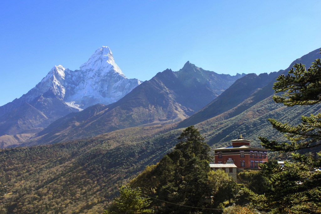
Today's trail is dramatically beautiful. From the village we climb steeply for 20 mins to a small pass. From here you get the view of the famous Tyangboche Monastery with Mt. Thamserku and Mt. Kangtega as a back drop. The trail from here is undulating and follows the contour of the hillside with narrow exposed trail looking down on the main Everest trail and Imja Khola. Fantanstic views of Mt. Amadablam, Mt. Thamserku, Mt. Kangtega and the Lhotse face are seen with just the top of Mt. Everest peeing from behind. You will also get to see plenty of Thar, which is a mountain goat, and massive Himalayan Griffon vultures and Golden Eagle.
Distance: 4 kms
Trekking: 3 hours
Elevation of Amadablam Base Camp: 4700m
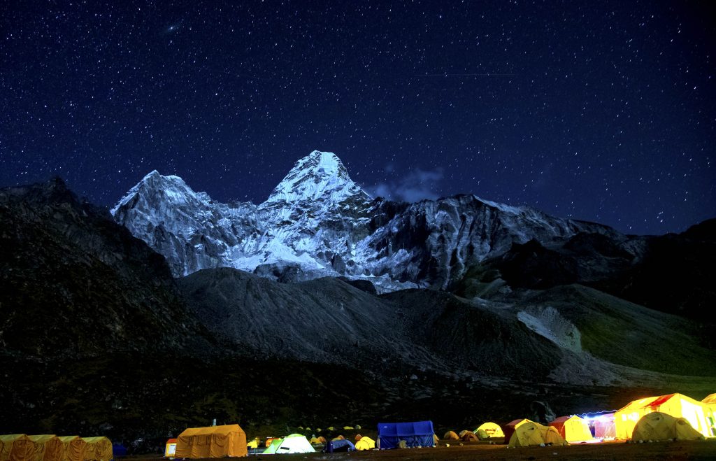
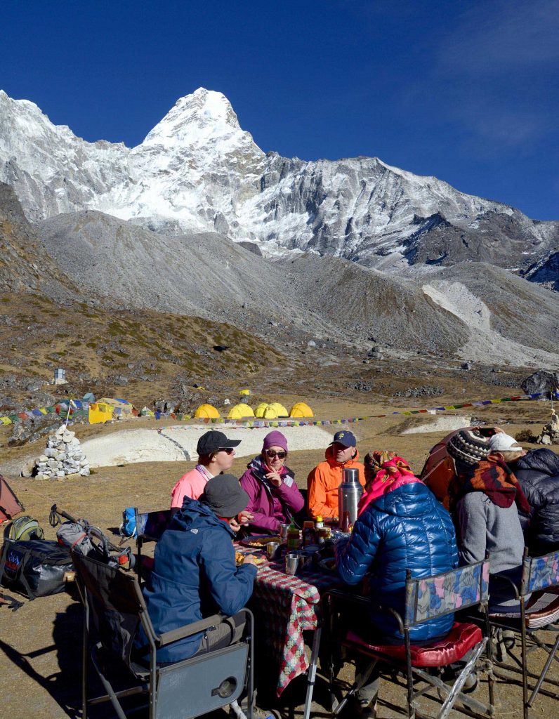
The trail pass through the Lower Pangboche village to the Imja Khola where we cross a small iron bridge. From the other side of the river the trail steady climbs steadily all the way to Amadablam Base Camp. Amadablam Base Camp is considered to be the most beautiful base Camp in Nepal. It is a flat pasture with a small stream flowing right from the middle of the pasture. The view of Mt. Amadablam towering more than 2 vertical kms above is simply awe inspiring. If it is during the climbing season, we will stay at a tented campsite along side the expedition group. It is absolutely fascinating to witness climbers approaching summit climb, which we can see from the comfort of our tents. When it is not climbing season, we can stay at a nearby lodge which has very good sleeping and eating facilities, just as any other lodges along the trail.
Overnight camp or tea house
Distance: 14 kms
Trekking: 6 hours
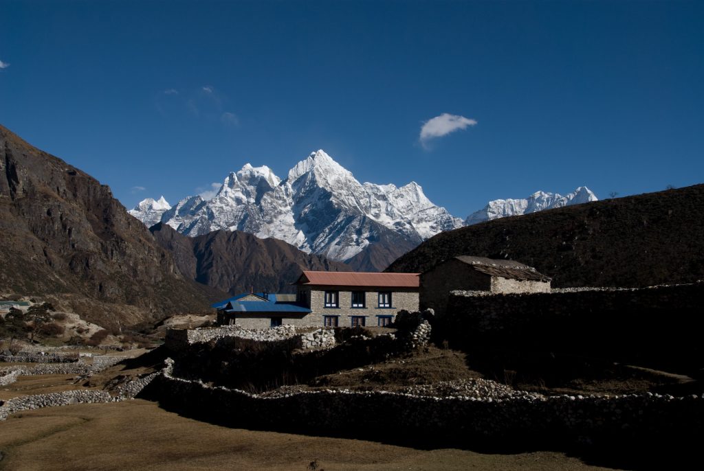
Elevation of Tyangboche: 3830m
Elevation of Khumjung: 3790m
We will have a relaxing morning enjoying the grandeur of the majestic Amadablam. If there is a group attempting for the summit, it will be a fantastic show to see tiny dots of climbers on the near vertical slopes leading to the summit. After breakfast, we will begin our return back journey. A steady descend of an hour and a half will bring us down to Pangboche. After Pangboche the trail begins to descend alongside the Imja Khola for about 30 mins where we cross a small metal bridge. After the bridge you enter a beautiful rhododendron and birch forest where the trees are covered with mosses and lichens, giving it an enchanted forest feeling. From here another hour and a half climb on gentle gradient through a fairy tale like forest will bring us to Tyangboche monastery. Look out for Musk deer and the colorful peacock like Danphe (Impeyan Pheasant) which is the national bird of Nepal. We will order lunch at a lodge and then go to visit the monastery. The monastery is about 200 years old. The walls of the monastery contains intricately beautiful Buddhist paintings. The building itself is perched on top of a ridge at a picture perfect location with Amadablam and Everest as a backdrop which makes it popular among photographers.
After lunch we will descend to Dudh Kosi for about an hour and a half. We will cross the river on suspension bridge and then a steady climb for about 2 hours will bring us to Khumjung.
Distance: 12 kms
Trekking: 5 hours
Elevation of Monjo: 2835m
The village of Khumjung does not lie on the main trail, therefore it is not as busy even though the village is the largest settlement of the Khumbu region. The village has a small monastery where there is a "yeti scalp" inside a glass box. There is also a high school build by Sir Edmund Hillary. After breakfast, we will trek to Namche Bazaar, passing by the high school. A short climb will bring us to a Yak farm, and then descend to Syangboche STOL (Short Take Off and Landing) airstrip. This airstrip is used to bring in supplies with Russian built MI 17 helicopters. From the airstrip a steep descend will bring us to Namche Bazaar. We will spend some time here for shopping souvenirs and also have lunch either at a lodge or at the bakery if you wish to.
After lunch we climb down the steep Namche hill to the Dudh Kosi and follow it to the entrance of the National Park at Monjo. After checking out our permits, we will check in to our lodge.
Distance: 12 kms
Trekking: 4 hours
Elevation of Lukla: 2850m
Today is the final day of your trek, back tracking the way we started this epic journey. On arriving Lukla you can check in to your rooms and then fix a meeting with the staff for the last night party. Your guide will arrange and fix a time for the evening. You can collect your group tipping and give it to your guide. He will put them in separate envelopes according to the names of the staff and their share and give them back to you. Usually our groups have a farewell speech and distribute the tips which will be followed with a few song and dances.
Flight: 15 mins
Drive: 145 km, 5 hours
Weather permitting, we will fly early to Ramechhap and then drive to Kathmandu. Upon arrival to Kathmandu we check in to our hotel and the rest of the day is free to take showers, spa, shopping etc.
We have allowed this extra day as a buffer day in case of flight cancellation from Lukla back to Kathmandu. If we have not used this day for any delays contributed to flight cancellations, then we can use this day for sightseeing around Kathmandu valley.
Places you will visit:
Boudhanath Stupa: It is the largest stupa in Nepal and the holiest Tibetan Buddhist temple outside Tibet.
Kathmandu Durbar Square: Commonly called Basantapur Darbar is one of three Durbar (royal palace) Squares in the Kathmandu Valley in Nepal, all of which are UNESCO World Heritage Sites.
Durbar Square was surrounded with spectacular architecture that showed the skills of the Newar artists and craftsmen over several centuries, but several buildings in the Square collapsed due to a major earthquake on 25 April 2015.
We will drive you to Tribhuwan International airport about 3 ½ hours before your departure time.
Price Includes
- All internal transportation, in private vehicle.
- Services of English-speaking guide, porter‟s and sherpa‟s assistance
- 4 nights in tourist class hotel on bed and breakfast basis while in Kathmandu
- 1 night in tourist lodge at Ramechhap
- Welcome dinner.
- Half day guided city tour with lunch.
- Use of a personal trek pack consisting of a duffel bag, Tshirt, down jacket and sleeping bag.
- Return air fare to Kathmandu/ Lukla/ Kathmandu with domestic terminal taxes.
- All meals while on trek.
- Afternoon tea/coffee service on arrival at the lodge
- Twin share accommodation in trekking lodges with shared bath and toilet facilities
- National Park fees,
- Staff insurance, tourist service fee and all taxes applicable as per state law.
Price Excludes
- Personal accident and rescue insurance. You must provide your own rescue insurance
- Mineral water, beer, soft drinks and extra tea/coffee outside of normal meal times
- Private room accommodation in Kathmandu unless a single supplement is paid
- Optional tips to guides & porters
- International airport departure taxes
- Visa costs
- Helicopter evacuation in the unlikely situation, although we do arrange for it and make the necessary
- documents so that you can claim from your insurance.
Map
Everest Offbeat trek with Renjola, Gokyo and Amadablam Base Camp
We begin our adventure with a spectacular flight to Lukla. The first couple of days we trek through alpine forests along the Dudh Koshi river to reach Namche. We take a couple of days halt here to acclimatize by walking in and around Namche as acclimatization cannot be done in a hurry. A hike to Everest View Hotel, which is a 400m climb from Namche Bazaar will complement our acclimatization and also provide us with breath-taking vistas of Mt. Everest and the surrounding peaks.
After Namche we leave the main “Everest Highway” and head west towards Thame valley. After a few days trek through this beautiful Thame valley we enter the Gokyo valley across the Renjo La, form where you get the best view of Mt. Everest with Mt. Makalu, Mt. Lhotse and dozens of surrounding mountains. At Gokyo we will stay near the beautiful turquoise glacial lakes, which along with the Ngozumpa glacier are the source of the Dudh Koshi. The next morning climb Gokyo Ri, which is often debated as a better view point than Kalapathar near Everest Base Camp. We will trek down the Gokyo valley and turn east to Phortse and Upper Pangboche. One of the highlight of this trek is an overnight stay at Amadablam Base Camp. Mt. Amadablam is not only considered as one of the most beautiful mountains in the world, but it is also one of the best rock- ice mixed climbing mountain, not to mention that it’s Base Camp is amazingly beautiful with an undisturbed view of Amadablam right in front of you. On our return journey we will visit Tyangboche monastery, a 200 year old monastery with a striking location with Everest and Amadablam as a backdrop making it very popular for photographers.
Grading: This expedition is graded D which is equivalent to physically demanding and challenging.
Stamina is essential, as walking days are long. We recommend previous trekking experience, preferably at altitude. Walking or jogging 45 mins to 1 hour for at least two times a week on undulating terrain or on a tread mill with inclined angle for at least 3 months prior to departure. Cycling is recommended. Long day hikes on weekends with a daypack in variable weather conditions is also recommended. We strongly recommend you to undergo extensive physical training at least 4 months prior to the expedition.
Summary
- Trek Distance: Approx. 135 km
- Maximum altitude: 5352m (17,559ft)
- In / Out: Kathmandu
A Day on Your Trek
Although each day is different, considering the weather, general pace of the group and length of the days walk, in general your day begins with a wake up tea at around 6 to 6:30 in the morning. You will then be provided with a bowl of warm water for washing. Then you will need to pack your duffel bag and your daypack and come to the lodge’s diner for breakfast.
After breakfast we will hit the trail and usually walk for about 3 to 4 hours before we stop for lunch. We will give you about an hour and a half rest during lunch, which will also give enough time for the staff to have their lunch and pack. Usually after 3 to 4 hours of walking we finish the days walk by 4 PM. Tea/ Coffee and snacks will be served on arrival to the lodge. Your group Leader will often organize side trips in the afternoon. Your dinner will be served around 7 PM.
High Altitude
On this trek you will be going up to 5545m, so it is very important to understand the affects of altitude. The greatest provocation is going too high too fast. Hi On Life’s itinerary has been carefully designed to minimize the effects of altitude. We ascend slowly and surely allowing enough time for safe acclimatization.
Headaches and breathlessness are common at altitude which in itself is nothing to worry about. In rare cases, this may worsen to Acute Mountain sickness (AMS), so a close watch is kept on all trekkers by the group leader who is trained to recognize the symptoms of AMS which are severe headaches, nausea, lethargy, loss of appetite serious breathlessness even at rest. If any trekkers show such signs they will be descended to relatively lower and safer altitude. The Group Leader’s decision on evacuating such person to a safe altitude is final. Do not medicate yourself without first informing your group leader. Going to altitude slowly with adequate rest and adequate intake of fluid (3 to 4 litres per day), you will most likely have no problems apart from breathlessness on hills which is completely normal as the percentage of Oxygen in the air is relatively lower to that at sea level. The most important thing is not to worry about altitude because our team is there to take care of you.
Staff
Group leader: your most important member of your staff. Our Group leaders are highly trained in all aspects of the trek, conservation, first aid specializing on altitude sickness, emergency procedures and have extensive knowledge of the natural history of the area.
Sirdar: His job is to manage and organize staff duties. He is responsible for the actual operation of the trek.
Sherpas: Their job is to lead your way and distribute equal loads to the porters.
Porters: They are responsible to transport your duffle bags and their job finishes once they reach the designated lodge. Our porters are provided with Gore-Tex suits, trekking boots, gloves, hats, socks, snow gaiters and snow goggles. Most importantly, we regulate them on a 25 Kg carrying which no other company does. Our clients can therefore feel comfortable knowing that our porters are working in a good humane condition. During the trek you can see porters carrying 60-70 kg and sometimes even more than 100 kg!!)
Weather:
Oct/Nov and March/April
On the trek at lower altitude (2500m to 3500m) during daytime the Max temp can be around 15C to 20C and the Min temp can be 0C to 5C
At higher altitude (3500m to 5000m) the daytime Max temp can be between 5C to 10C and Min temp can be between -6C to OC
Please note: when there is an overcast sky, the day time temperature can get down to -2C during day time at altitudes above 4500m. Also the wind makes a big difference in the real feel of temperature.
Dec to end of Feb
On the trek at lower altitude (2500m to 3500m) during daytime the Max temp can be around 2C to 7C and the Min temp can be – 5C to 2C
At higher altitude (3500m to 5000m) the daytime Max temp can be between -5C to 5 C and Min temp can be between -8 C to -20C
Please note: when there is an overcast sky, the day time temperature can get down to -5C during day time at altitudes above 4500m. Also the wind makes a big difference in the real feel of temperature.
This is just general information and it could vary.
Recommendations for things you should bring:
Clothing:
Head:
- Warm hat wool or synthetic that covers your ears
- Sunhat
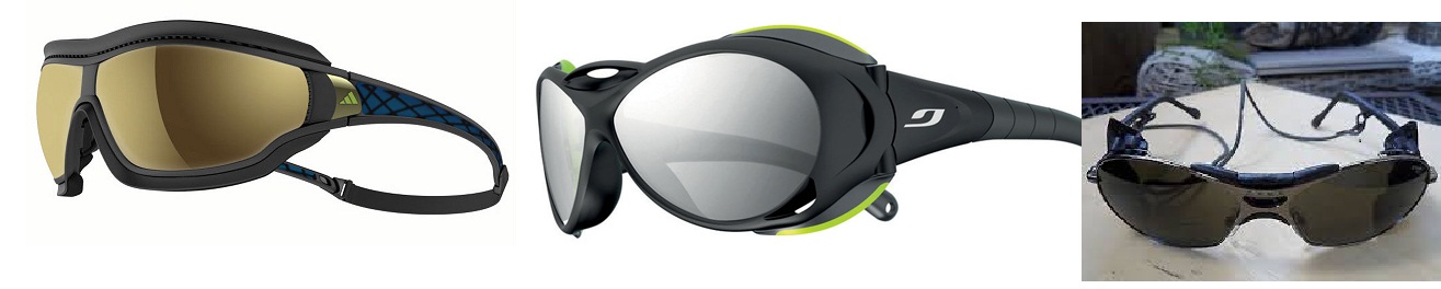
- UV shield/ Category 2 sunglasses
- Headlamp with extra batteries
- Bandana or head scarf, also useful for dusty conditions
Upper Body:
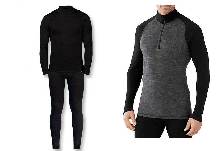
- 2 polypropylene or wool mix t-shirts
- 2 polypropylene or wool mix long sleeve t-shirts
- 2 long sleeve thermal underwear shirts, lightweight preferably woolen
- 1 polar fleece pullovers medium weight
- 1 polar fleece jacket, OR Primaloft/ Down light weight jacket
- Gore-Tex jacket with hood, waterproof and breathable
- For high altitude use, 1 very warm goose-down jacket with hood (we provide this)
Hands:
- 1 pair medium weight wind stopper gloves
- 1 pr. lightweight poly-liner gloves
Lower Body:
- 1 pair walking shorts
- 1 to 2 pair walking trousers for trekking
- 1 pair stretchable running trouser for evening wear at lodges
- 2 pair lightweight thermal bottoms
- 1 pair Gore-Tex trousers, wind stopper
Feet:
1 pair trekking /walking boots with good ankle support
1 pair trainers, running shoes and/or sandals for Kathmandu and in lodges;
2 pair med weight preferably wool socks
2 to 3 pair of liner socks. Polypropylene or wool
2 pair lightweight trekking socks, poly or wool
Sleeping:
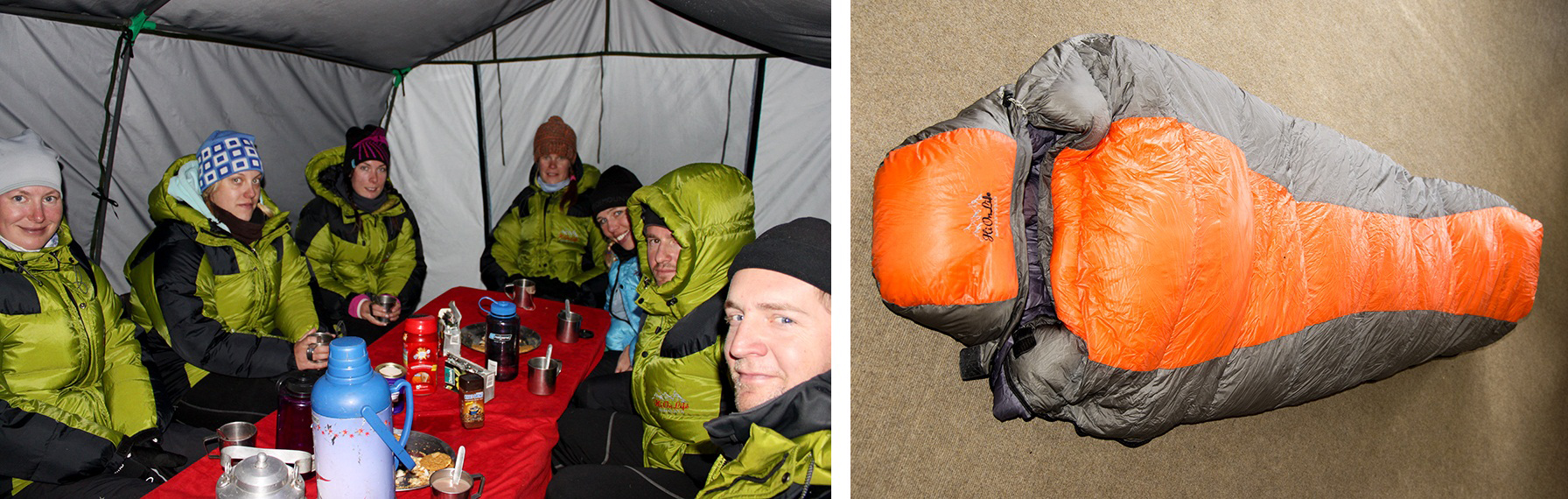
We provide:
- 1 down sleeping bag (rated to – 20 Centigrade or -0 F )
- 1 polar fleece liner
Rucksack and Travel Bags:
- 1 medium rucksack (30-35 litres)
- We provide you 1 big duffle bags.
- Small padlocks for duffel kit bags.
Assesories:
- 1 small roll of repair tape, 1 sewing repair kit
- Camera
- Nylon stuff sacks for food and gear storage, large Ziplocs are useful also
- 2 Water bottles (1 litre)
- 1 small folding knife
- Books, playing cards, ipod/mp3 player, games, small musical intruments
- Adequate amount of batteries, etc.
Health and trouble free holiday
There are no compulsory vaccinations required for entering Nepal. However please consult a doctor for vaccination against Typhoid, Meningitis, polio, and hepatitis. If you have special dietary requirements or allergies, please through your agent, give us a list of what you can and can’t eat so that we can provide proper food for you.
If you are undergoing a course of prescription medicine, please ensure that you have sufficient supplies for the entire holiday. Some types of drugs including antimalarials have side effects at high altitude; therefore please consult your doctors regarding these drugs. The places you trek are mosquito free and there has been no report on malaria in Kathmandu for the past couple of decades.
Insure yourself
We highly recommend you to take a comprehensive Personal Travel Insurance before leaving home. This should cover for your loss of baggage, airline delays, sickness and accidents. And it should also cover you for Emergency Helicopter Evacuation.
In case of Lukla flight cancellation: Sometimes due to bad weather Lukla flights get cancelled. This may make it difficult for you to connect with international flights. In such an event and if the group as a whole wishes to charter a helicopter, which is an ideal solution to Lukla flight delays, we can arrange for it. Your will need to pay about 400 USD per person.
Money Matters
The ideal currency to bring with you is USD.
In Kathmandu: Each meal will cost around 4 to 6 USD. Plus 10 to 20 USD for your taxis if you wish to go around the city.
On trek: You will need around 6 to 10 USD per day. This money is for your hot showers, chocolates, soft drinks and beers etc and also for small donations in the monasteries.
Tipping
Although tipping is entirely optional and personal matter the following is recommended as a guideline
In Kathmandu: for bellboys, waiters and porters 30 to 50 Nepali Rupees
On the trek: At the end of the trek it is a customary to tip the field staff.
- For Staff: 100-120 USD depending on group size. The group leader will collect the tip and then split it between the staff and put it in envelops so that the trekkers can give it to the staff during the “Farwell Ceremonies”. Your Group Leader is not included in this tip.
- For Group Leader: 30 to 50 USD per person
Some Do’s and Don’ts
Nepalese people treat visitors as special guests. Although they will never rebuke you publicly for unknowingly offending them, we must consider their culture.
While in Nepal please observe the following:
- Full or partial nudity is not accepted
- Over display of affection between men and women, especially in temples and monasteries are discouraged
- Please remove your shoes before entering monasteries and temples
- Never point the soles of your feet at a person or shrine
- Many Hindu temples are closed to non-Hindus. Please ask before entering
- Locals walk around the Mani walls and Stupas in a clockwise direction as a respect and they expect you to do the same although it is not compulsory
“TODAY IS YOUR DAY! YOUR MOUNTAIN IS WAITING, SO… GET ON YOUR WAY!”
DR. SEUSS